Nervously watching Michigan’s beach expansions
The joke among the people who share the Lake Huron cove on which our summer home sits is that the township may soon try to tax us on the extra land we've all been acquiring in recent years.
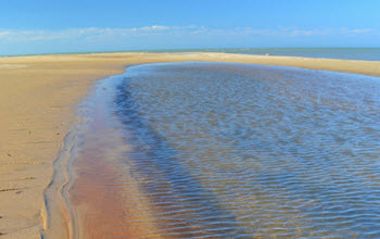
This is not property we've bought, or inherited, or won in poker games; it's a gift from Lake Huron. The fact that we don't particularly want it makes no difference; Lake Huron will take it back only in its own time, if ever. The more the lake recedes, the wider our beaches get. Since we bought the property in 1992, the lake level has, with a few exceptions, gone only one way: down.
You've heard the stats: As of February, Lakes Huron and Michigan were 29 inches below their long-term averages, and had dropped 17 inches in 2012 alone. In January, the lakes reached their lowest point since 1918, when record-keeping began.
My neighbor to the north of us on the cove is a year-round resident who has lived on the lake for 30 years or so. He has a photo -- circa unknown -- that shows the lake lapping at a metal property stake about 50 yards from our back door. Since our cottage sits on a modest bluff -- 10 steps up -- the water was never a threat, even then, but it's hard to imagine that the lake was once that close. Now you have to walk 75 yards from that same back door to get a toe in the water. Our surf-smoothed “diving rock,” the traditional destination for people frolicking in the water in front of our place, was once a foot under water; now it protrudes a foot or more above the surface. A rocky point that was once submerged basks in the sun.
It was a mere 30 years ago when lake levels were at an all-time high, and some homes on Lake Michigan, surrendering to erosion, toppled into the water. Just before we bought our place, we put in an offer on a cottage near Manistee. Before we sealed the deal, I did a little research and learned that cottage was in a “high-risk erosion” area, the water encroaching at a rate of 18 inches per year. I pictured myself lying awake at night thinking about my high-priced real estate disappearing, day by day, into Lake Michigan. We withdrew our offer and began looking on the sunrise side, where erosion was negligible. Who could have guessed that I would lie awake at night thinking about all the real estate I was gaining?
I launch my boat at the Hammond Bay Refuge Harbor, three miles from our cottage. It's a first-class state facility with two concrete boat ramps. But I'm glad I have a relatively small boat (a 17-foot Four Winns) because my neighbor on the south side, who owns a bigger one, can no longer launch it at Hammond Bay. The water is too shallow. He has to drive 14 miles to the boat launch in Cheboygan. He's not happy about that.
I can launch OK, but the low water poses other perils. Having trolled for salmon in and around Hammond Bay for 20 fishing seasons, I've learned where to go and where not to go -- not only in my pursuit of fish, but also to avoid what the boat insurance people call underwater collisions. A bus-size boulder lurking a foot under water can do more than mangle a propeller; it can crush a motor's lower unit like an empty beer can. Some of the lessons I've learned in that regard came the hard way -- the expensive way. And just when I thought I had my territory all scoped out, the water level went into free-fall, meaning, in a sense, that the boulders began to rise. Some that were safely under water are now lying in ambush.
The cause of the drop: A string of years with below-normal rain and snowfall and higher temperatures, which increase evaporation. That's the natural cause; some studies have shown that dredging in the St. Clair River -- to deepen the channel for navigation -- has cost the lakes up to 16 inches.
A wet February brought lake levels up slightly from the record lows, and maybe this year's snow melt, combined with a juicy spring, will add another inch or two. It seems likely, however, that I'll be keeping a sharp eye off my bow for a long time to come.
See what new members are saying about why they donated to Bridge Michigan:
- “In order for this information to be accurate and unbiased it must be underwritten by its readers, not by special interests.” - Larry S.
- “Not many other media sources report on the topics Bridge does.” - Susan B.
- “Your journalism is outstanding and rare these days.” - Mark S.
If you want to ensure the future of nonpartisan, nonprofit Michigan journalism, please become a member today. You, too, will be asked why you donated and maybe we'll feature your quote next time!


 CONVERSION: Sand is replacing water as beaches grow along the shores of Lake Huron, a consequence of declining water levels. (courtesy photo/used under Creative Commons license)